EO Lab
Earth Observation Lab
The Earth Observation Lab covers all observational scales, from satellite via airborne remote sensing with drones and micro light aircrafts to ground-truthing with distributed wireless environmental sensor networks.
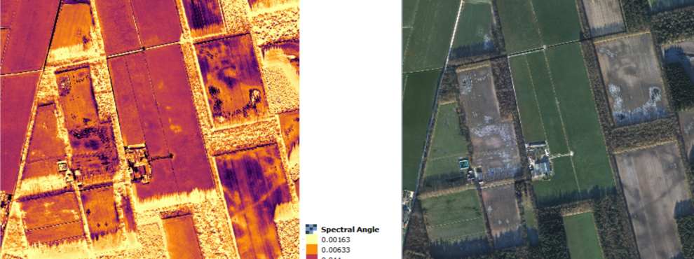
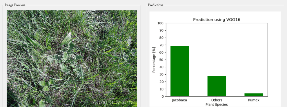
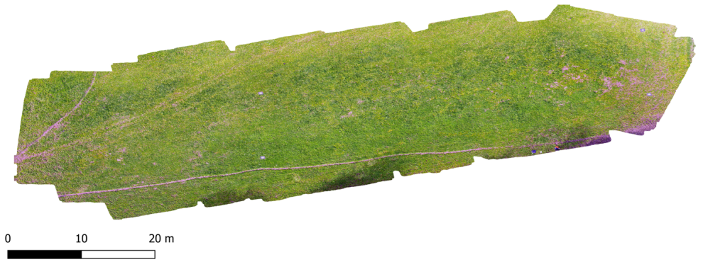
Remote sensing data can be used for innumerable applications across a variety of academic disciplines. Key applications addressed by the EO-Lab include; precision agriculture, environmental monitoring, terrain modelling, soil analysis, structural health, civil engineering, surveying, and traffic analysis. The EO Lab also has a strong focus on the collection and analysis of ultra-high spatial resolution hyperspectral datasets using Unmanned Aerial Systems in conjunction with Universities’ Drone Lab.
The EO-Lab high-performance computing cluster tackles the following issues of efficient management of large amounts of data, post-processing of hyper- and multispectral data, image processing and analysis, data-mining, feature recognition and extraction as well as machine learning.
Equipment
OLGA: Observational Light Aircraft for Geoscience Applications, Gyrocopter AutoGyro MTOsport
High-performance computing cluster
Ocean Optics Point Spectrometers:
- 3x Red Tide USB650 (350-1000nm)
- 1x Flame (190-1100nm)
- 1x Flame NIR (950-1650nm)
Digital Cameras:
- 2x Panasonic Lumix GX8 (20 MP)
- 1x Panasonic Lumix GX1 (16 MP)
Hyperspectral Cameras:
- Specim FX10 (Pushbroom, 400-1000 nm)
- Specim FX17 (Pushbroom, 900-1700 nm)
Hyperspectral camera assembly (Pushbroom, 400-950 nm):
- In-house development
- Photon Focus MV1-D1312IE-100-G2-12
- Specim Imspector v10 Spectrograph
XSens MTi-G-700 IMU
"Field Scanner" for outdoor hyperspectral imaging
Scanner for indoor hyperspectral imaging
Quicklinks
Room
02 02 505
Opening Times
By appointment
Lab Management
Prof. Dr.-Ing. Rolf Becker
Contact
Prof. Dr.-Ing. Rolf Becker
rolf.becker@hochschule-rhein-waal.de